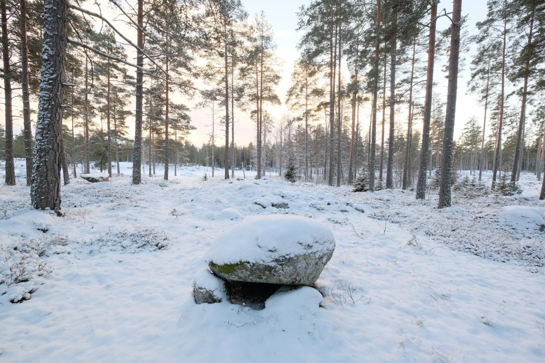
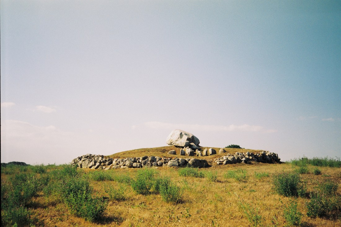
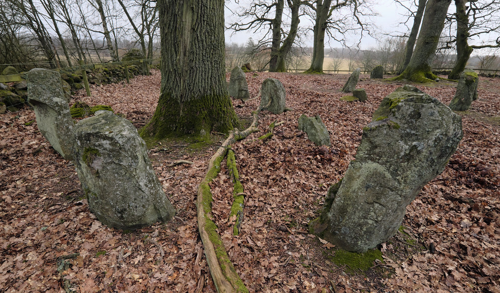
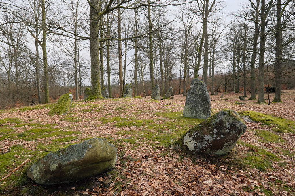
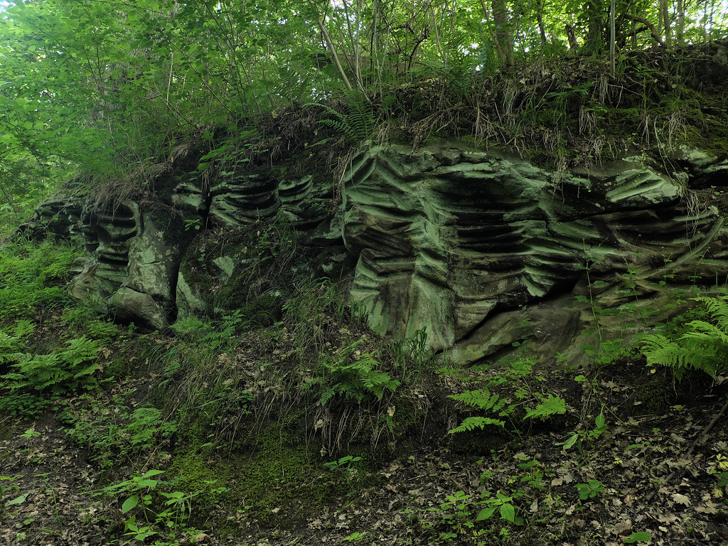
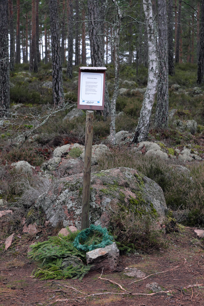
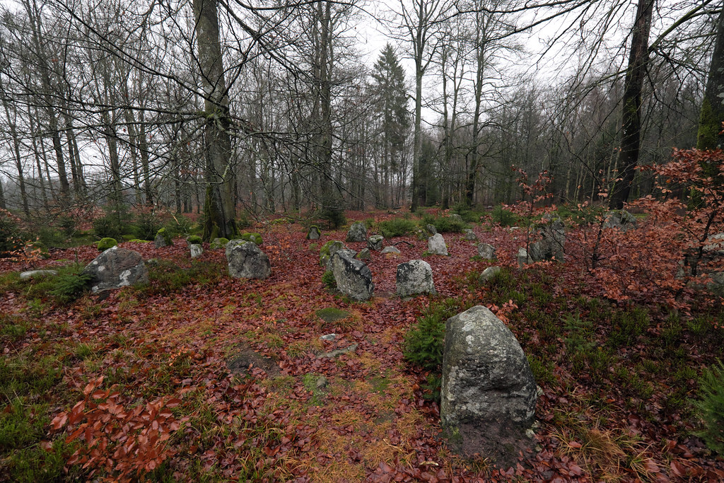
Snäckedals is a notable grave field located north of Snäckedal farm in Misterhults parish near Oskarshamn. This burial ground is dated to the Bronze Age, containing 26 ancient remains, and is one of the biggest of this kind to be found in Sweden. Back in the ancient times it was probably an important ritual and spiritual center, perhaps a final resting place for the elite involved in the copper trade.
First time I explored the area in September ’17 on a misty day when the heather was in full bloom. Though currently hidden under a layer of snow, most of the graves are still discernible: 5 cairns, 13 round and 5 rectangular stone settings, 2 ship-shaped stone settings – one of them being 40 meters long is the largest in Sweden, as well as a small raised block (so called höna på ägg) which is my favourite. The largest cairn is 21 meters in diameter and 3 meters high.
The small raised block resembling a mini-dolmen or a nesting hen is actually a man made stone formation found on some Bronze and Iron Age burial sites in Sweden. Originally raised as graves, they were used in various rituals later on (often as offering stones), or being surrounded by superstitions were thought to be dwellings of supernatural beings.
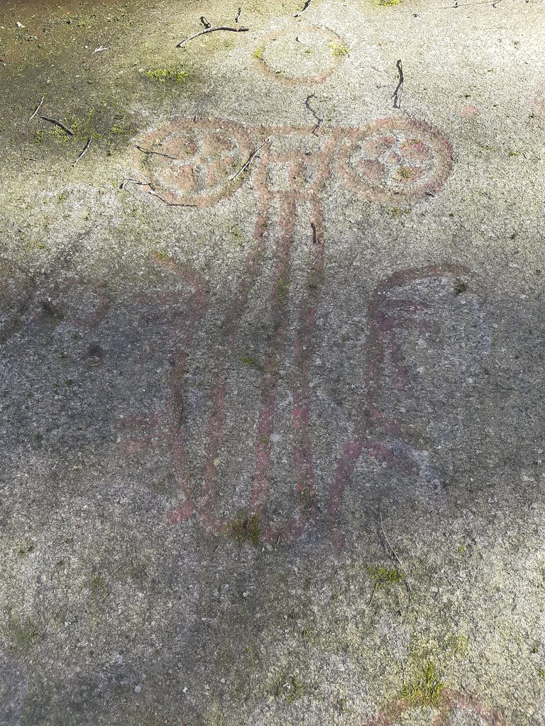
The area between Gladsax and Baskemölla is a distinct ancient landscape that is abundant in burial sites from different eras. One of them is located on a hill behind Rosdala Farm. The very much unique Stenstuan – a passage grave from the Stone Age.
Stenstuan was erected during the Farmer’s Stone Age and was used as a tomb for many generations. What makes it so unique is a variety of petroglyphs carved on its capstone. However, most of the carvings were added during the Bronze Age. Some researchers believe that a part of the 90 cup-marks at the top of the block, may have been carved when the tomb was built. In that case, there is a difference of a couple of thousand years between the first and last carving. The motives are quite few, but the variation is great. There are ships, axes, sun wheels and a circle. One ship carries a sun figure while another – a bowmen. The circle has been interpreted as a bracelet.
The grave was excavated in 1978 by Göran Burenhult. Many exciting discoveries were made, mostly from the Stone Age. Around 4000 ceramic fragments were found at the entrance to the chamber. Other finds included amber beads, burnt mussel’s shells, chisels and broken flint axes.
Photos taken with Olympus Mju I with a Fujicolor 100 negative.
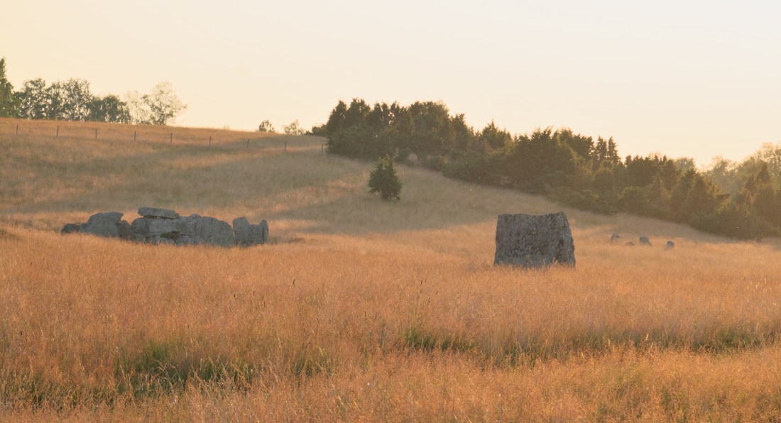
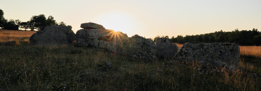
As soon as we installed ourselves in Skövde, we drove up here after a day long drive down from Bollnäs. Just in time for the sunset. Last warm rays of sunlight made the grass turn copper; swarms of flies became fairy dust. As I was walking around the meadow a pair of birds kept me company and followed me wherever I went. Even though I couldn’t identify them, I was grateful for their company for the evening, as it sometimes gets lonely among the graves. Soon after we left to catch Amundstorp in the last moments of the golden hour.
Ekornavallen is an ancient burial ground in the Falköping Municipality in Sweden. Situated in Slafsan River valley, it contains a variety of ancient monuments dating from the Stone, Bronze and Iron Ages.
What’s unusual, there were no settlements in the area until the 18th century. As of the late 19th century the area was plowed up, which sadly destroyed many of the precious remains.
Today Ekornavallen contains four passage graves and a gallery grave from the Neolithic period, as well as cairns from the Bronze Age, stone circles, twelve standing stones (bautastenar) – marking the Iron Age burials, eight round stone settings and one triangular stone setting. Many stones are adorned with cup marks too. It is estimated that the field was in use for over a six to seven thousand-year period.
The largest, and best known, grave on a meadow is the Neolithic passage grave Girommen. According to historians the name translates to thegiant woman’s oven. It could be a resting place of many individuals, possibly an entire family. The burial chamber is thirteen meters long and two meters wide. It stands on a barely recognizable stone setting that is 37 meters in diameter. All boulders are made of sandstone except for the granite roof stone; probably a glacial erratic from Närke. The grave was restored in the 1940s and some burial offerings such as amber beads, pottery shards and a flint chisel have been found. In recent years the walls has been filled to prevent the passage grave from further collapse.
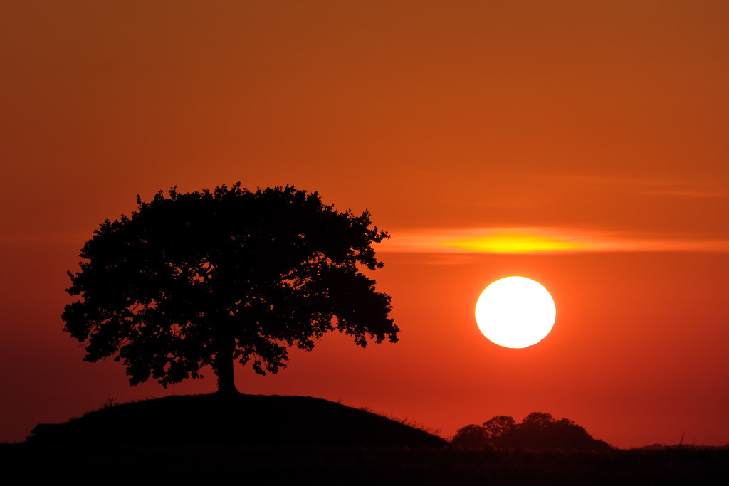
Last summer we often indulged ourselves with late afternoon rides around south-west Skåne. Whenever we rode, I’ve always noticed a mound with a lone tree in the distance. It always popped up over the fields and then quickly dipped again only to reemerge again few moments later. It didn’t matter from which direction we approached it; unconsciously we always ended up on the road that passed it.
We never stopped to investigate or to take any photos. That one evening though, during the harvest, seemed like a good opportunity to do so. Harvest dust and setting sun made the fields look like they were on fire.
Brytestuhög can be found just outside Hammarlöv on the road towards Östra Värlinge. The mound is not that impressive in size, but since an old oak grows on it, it’s easy to spot from a great distance.
Locals say that the place is haunted; there’s a folktale about a calf that sometimes comes to the farm next door and likes to help women who live there. Around Christmas time people light candles by the mound too.
Steglarps gravfält
Spetshög, Grefvie hög, Lille hög, Store hög, Sandhög, Grytehög and Melenhög are some of the names of twelve Bronze Age burial mounds found north of Steglarp in Skåne.
This grave field is one of the best preserved burial mound complexes in the Nordic region. The mounds are around 15-20 meters in diameter, while the two most prominent ones, named Bolmers Högar, are 25 meters wide. Twenty church towers can be observed from the mounds and an ancient dirt road still runs among them.
A local tale says that during Christmas Eve trolls can be seen dancing under the three golden pillars on the biggest mound. Another folktale mentions a supernatural hare, högfellaharen (the mound-trap hare), that lives among the mounds and drives hunters into their demise.
Once the hare appeared in a potato field and a farmer, protective of his crops, fired two shots at it. The man clearly saw that the hare got shot, but it continued to run as if nothing had happened. The farmer decided to follow through and fired twice more at the hare. Yet again the hare continued to run unharmed. The farmer got frightened and went home. Shortly afterwards he fell ill and died six months later. Another young man discovered that it was the högfellaharen that the late farmer tried to hunt down. He wanted to try his luck with the trickster hare too, so he tore off one of the silver buttons from his shirt and loaded the rifle with it. He succeeded and the hare was finally killed. When the man approached to examine it closely, he saw that it was just three wooden sticks and an old boot.
Sources:
Classon C., Duner A., Fornminen i Skåne. En vägvisare, Corona Förlag, Malmö 2001.
Last Thursday we decided to rent a car and go on a day trip in order to celebrate my incoming birthday and spring equinox. We might actually turn it into a quarterly road trip tradition.
Equipped with snacks, we leave the city early morning and head north-east towards Ringsjön lake. The morning sun looks promising, but grey clouds quickly take over the sky. We reach our first stop after a brief drive.
Trollakistan
Trollakistan stands by the road leading to Höör, just before it goes in between eastern and western part of the lake Ringsjön. We have passed this place many times on a motorcycle, so I’m surprised to see that the trees growing from the mound are gone. Only stumps (and litter) remain. Now I can see how the monument functions in the landscape, and imagine how it could look when it was first erected some 5,300 years ago.
Dolmen comes from the Farmers Stone Age period. No grave deposits were found during the excavation of the chamber. However, many flint tools, weapons, and pottery shards were excavated nearby. Fog starts to roll in as I circle the mound to find the best angles; not an easy task to do since the monument stands near the main road where the morning traffic is quite busy.
Nunnäs Gravfält
We leave the main road and head for the Nunnäs grave field that lays on the eastern side of Ringsjön. The rural road leads us among the foggy fields and pastures. Nunnäs site is located just behind a farm in Fulltofta. Unlike many other burial sites I’ve seen this looks like an old cemetery park – with its ancient trees and a stone fence. The place, also known as Grykull, comes from the Viking Iron Age and consists six stone ships, two judge rings, 35 raised solitary stones, and clumps of boulders. Originally it was much bigger; many of the stones are missing.
Vätteryds Gravfält
We’re soon back on the trail, and as we continue towards Sösdala we come across another burial site, Vätteryds, which is the biggest and best preserved Iron Age grave field in Skåne. There are around 375 stones on the pasture, but the records from 19th century mention that there were nearly 600 of them left back then.
There are 15 (!) stone ships of various design, a judge ring, two rectangular stone graves and many scattered solitary stones that perhaps once were a part of a bigger structures. The tallest boulder is over 2 meters high. Each stone setting contained a cremation burial of several generations of people. Stone ships were most likely intended for Viking chiefs and warriors. Neolithic settlement was also discovered nearby during the excavations.
According to the local folklore one of the stones was a home to a giant named Klack. Klack had a nasty habit of kidnapping the local girls. When the villagers grew tired of his doings, they attempted to fight him. The stones scattered on the field are supposed to be a memorial of this long and tough battle.
Häglinge Gravfält
Häglinge grave field is in close proximity to Vätteryds site. It’s also a stone throw from Källundagård; the farm that supplies my bakery with rye. This is the third Viking Age burial place we’re visiting today, but no less impressive.
The stones are located on a hill, so they’re not directly visible from the road. There are two stone ships and nearly 70 standing stones on the site. However, it’s hard to imagine how the grave field once looked, since most of the stones are destroyed. What I really like about this place is the green glow and calming omnipresence of moss.
The incredibly tall boulder at the back draws my attention; perhaps once it was of great importance. I think I can see a hidden face on it, but it just might be my imagination.
Petroglyphs in Frännarp
We finally arrive here early afternoon. We eat lunch in the sun while listening to a weird bird symphony – woodpecker’s ferocious pecking and continuous croaks of a raven family circling high above our heads. The site really makes a great bird observation spot. Carvings are located a bit deeper in the thicket, overlooking a small lake.
Frännarp’s petroglyphs were discovered in 1906 by one clumsy cow that slipped on the rock slab and tore away the moss covering the carvings.
No other place in Sweden has such a diversity of wagon carvings; it’s also Skåne’s only petroglyph site that isn’t located near the coast. There are around 17 two-wheeled carriages, some of them are pulled by horses. In addition there are sun wheels, snakes, a ship (or not; my sources are contradictory), 61 cup marks, miniature foot soles and a few unidentified figures.
Symbols were most likely carved during the Bronze Age. Back then pastures and cultivated fields dominated the surrounding landscape. The presence of wagons and sun wheels not only correspond to the daily farming struggle and dependence on cycles of nature, but can also be connected to fertility rituals performed to secure a good harvest.
Sources:
Enoksen Lars Magnar, Skånska fornminnen, Historiska Media, Lund 2001.
Classon Christer, Dunér Anders, Fornminnen i Skåne, Corona Förlag, Malmö 2001.
It’s been a year since my trip to Gantofta and I think the time has come to write about it. All those months I’ve kept saving it for later, hoping the memories would age like a fine wine, but instead they’ve started to wither. It’s really hard now to excavate the whole experience intact from the depths of my mind. I mostly remember the rain and my feet getting wet but also the exhilarating freedom and joy I felt after each of my tiny discoveries.
One rainy Monday in March I’ve decided to hop on a train and ramble around the Råån’s valley. My hike started at Gantofta’s station since the village is directly accessible by train from Malmö. The weather was fine by the time of my arrival but, as soon as I’ve headed for Bårslöv, it started to rain again. Undiscouraged by moisture I crossed the river and continued towards Stenlösorna Dolmen.
Stenlösorna is hidden on a neglected meadow behind private premises on the left of the road to Bårslöv. It’s overgrown with bushes and guarded by a hawthorn tree. Hawthorns symbolism in folklore is somewhat similar to an elder; it too stands at the threshold of the Otherworld. The dolmen’s capstone is covered in lichens and moss, though still some cup marks should be visible. As per usual I haven’t noticed any.
After a brief investigation I’ve turned back towards Gantofta and followed the road leading to Fjärestad. It was a 3-4 km walk along a less busy road during the worst rain; then a quick stroll through the Fjärestad Gård where the time has stopped. After a while I’ve found myself on a gravel road that led through the sleeping fields. An overgrown Bronze Age burial mound can be seen from there; looking like a crown in the middle of a field.
The rain stopped immediately after I’ve reached Fastmårupsdösen. The universe smiled at me – I could easily snap some photos. Similarly to Stenlösorna, I’ve learned nothing about it since the place hasn’t been excavated nor any on-site information is provided. I can only rely upon the dry field notes I’ve found on raa.se. In this case the capstone is also adorned with cup marks.
I’ve taken off my raincoat and had a small fika to recover my energy. I’ve had to decide whether I want to go back to Gantofta by the exact same way I came, or take a risk and go down the valley and cross the railway. Since I knew that the dolmen is aligned with Gantoftas Sliprännor I went with the latter.
So I went down the soggy meadow towards the railway. The railway itself wasn’t a problem to cross as I’ve thought before. Though a 3 meter wide river was. Surprise, surprise! There wasn’t any bridge I could take so I’ve decided to find one and walked down the stream.
As I was walking along the river I’ve crossed the Nature Reserve’s territory a couple of times. The hike would be so much easier and shorter if I wouldn’t have to crawl under the electric fences here and there. Though it definitely was fun. At this point my boots were totally soaked and I’ve started to get hungry.
In prehistoric times the region held an important central function and had been an attractive communication hub because of it’s incredibly fertile soils and close proximity to the sea. It’s quite clear from the number of visible ancient remains mainly in the form of a megalithic graves, Bronze Age and Iron Age burial mounds, settlements and fort ruins.
Closer to Gantofta, almost at the end of the nature reserve area, I’ve stumbled upon a mound with two old oak trees (found a noose hanging from one) with an unnamed passage grave in the middle. Unfortunately it hasn’t been restored yet, though it has been excavated in 1902. Back then archeologists found a few scattered deposits of grave goods: amber beads, flint tools and daggers, charred human bones, horse teeth, whetstones and ornamented pottery shards.
Just after I’ve made my final discovery, a wooden bridge appeared out of thin air. I’ve completed the quest. I could finally cross Råån safely and head back to the village.
I had a satisfying fika at Cafe Dalstugan. After talking to the lovely owner I’ve decided to walk through Gantofta to see Gantoftadösen again.
The dolmen can be found just at the end of the village. It’s also known as Jättestugan (Giant’s House). It was restored as the capstone has been broken in two. It features some cup marks as well, very visible this time.
I’ve visited Gantoftadösen already during the summer of 2017. The hike doesn’t have to end there, though last year it did for me. I headed to catch my train home. However, said summer, after continuing down the road for 15-20 mins I’ve reached the last stop on the map – Gantoftas Sliprännor.
The mysterious Giant’s Grooves are hidden in a tiny ravine under a lush foliage. This place is unreal. Like an enchanted emerald chamber; radiating green and moisture. There is a brook at the bottom too. One of the sandstone slopes is covered in peculiar grooves and cup marks.
It is unknown how, when or why the cuts have been created. They were once thought to be made by neolithic folk sharpening their flint knives and axes. Modern research shows that they were probably caused by a rotating motion instead, perhaps using a wheel or pendulum. Today it is believed that those cuts are the remains of magical and religious rituals.
Historical maps of the village of Gantofta show that during the Middle Ages there was an increased interest in owning a narrow plot of land right there, but the reasons behind it remain unknown.
Grooves are common in northwestern Skåne, especially in Kullaberga, but they can also be found on Gotland where they appear mostly on single boulders. In folk belief some of them are called sword sharpening stones.
A week after my day trip to Smygehuk my parents-in-law drove down and took us for a road trip around Österlen. It’s one of my favorite memories from last year.
We drove along the road number 9. It’s a smaller coastal road perfect for cruising and enjoying the view of the Baltic Sea. We had a fika in Smygehuk’s harbour and later continued along the road through Ystad to Simrishamn, where eventually we had a late lunch. The weather was quite enjoyable; the autumn sun hanged low, trees and grass already started to yellow.
A part of a humongous fairy ring I’ve spotted from the car.
The best part of the trip was a visit to Kiviks Musteri on the east coast. Since it was the apple season, they set up a small harvest festival: pick your own apples, have a fika and taste the local raw products. Before we enjoyed another cup of coffee and buns in the orchard, I’ve stocked up on apples and äpplemust.
While Kivik’s and Simrishamn’s areas are already quite familiar to me, we’ve checked out some previously unknown stone settings along the village roads.
Jarladösen
Jarladösen (Earl’s Dolmen) can be found behind a farm in Järrestad, close to where roads 9 and 11 join together. The village is famous for its well preserved petroglyph site Dansarens häll, which is located a bit towards Gladsax. We’ve already been there couple of years ago. But not many know about two dolmens hidden behind the buildings – Jarladösen, also known as Kycklinghönan since it resembles a hen, and Jarlafruns dös.
Skärabäcksdösen
Vik’s area is known mostly for close proximity of Stenshuvud National Park. But it’s also recognized for apple farming; orchards look truly beautiful this time of the year. Trees bend under the weight of apples as they ripen in the last rays of sunshine. At the end of the village we found Skärabäcksdösen – it was on my list for a while now, but as we took our time and went where the roads took us, we stumbled upon that one by surprise.
Vitabyhus
On the way back home, cruising through the farms and meadows, I’ve spotted some peculiar structures on the pasture past Vitaby. They turned out to be Bronze Age burial mounds. They are quite eroded now due to extensive farming. Originally it was four of them on the field, but I’ve spotted only two.
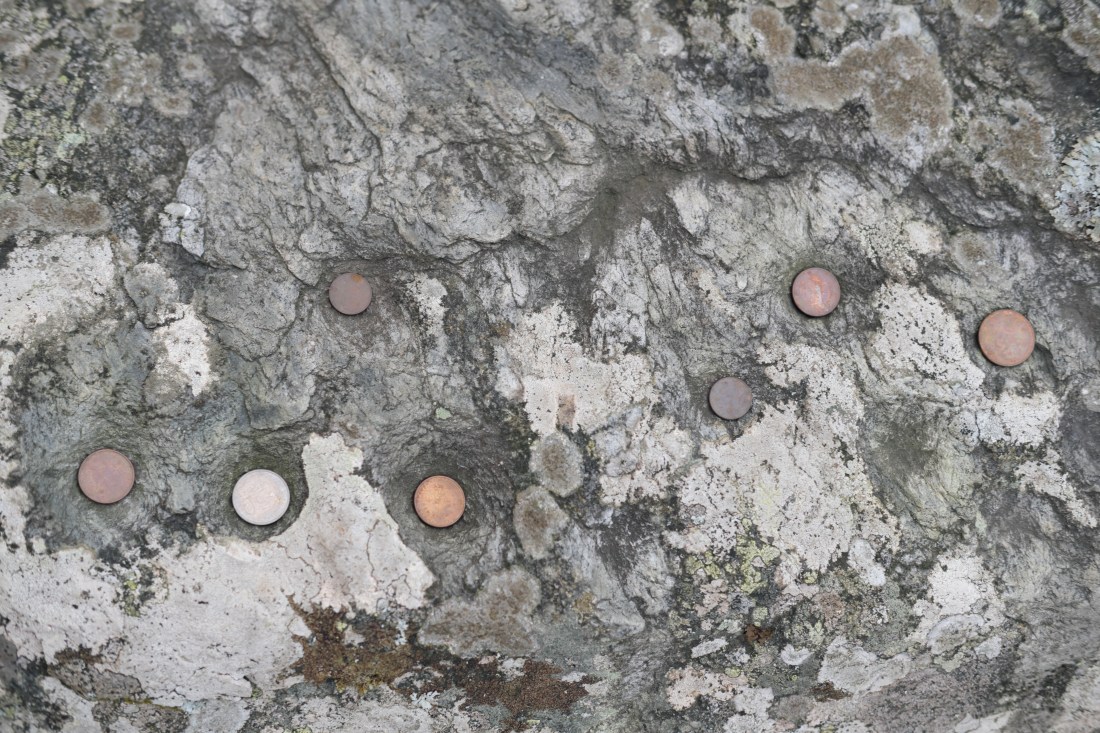
Stones with cup marks can be found in Ireland, Sweden, Estonia, Germany, Poland and many other countries. They first started to appear in Bronze Age among other rock carvings like ships, animals and human figures. They were also carved on cult stones from previous eras, e.g. on Neolithic dolmens. Cup marks also commonly appeared on tops and sides of freestanding boulders. After the disappearance of pagan religions they continued to be surrounded with magical practices and superstitions of rural societies.
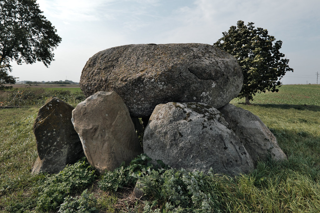
Erkes dös. A passage grave in Lilla Isie, Skåne
In Swedish lore cup marks were also referred to as älvkvarnar – elven mills, because people believed that elves use the pits at night to grind flour. Written records confirm that they were important in popular belief from the 17th to the 20th century. It doesn’t come as surprise that such stones have been a subject to many rituals and magical performances.
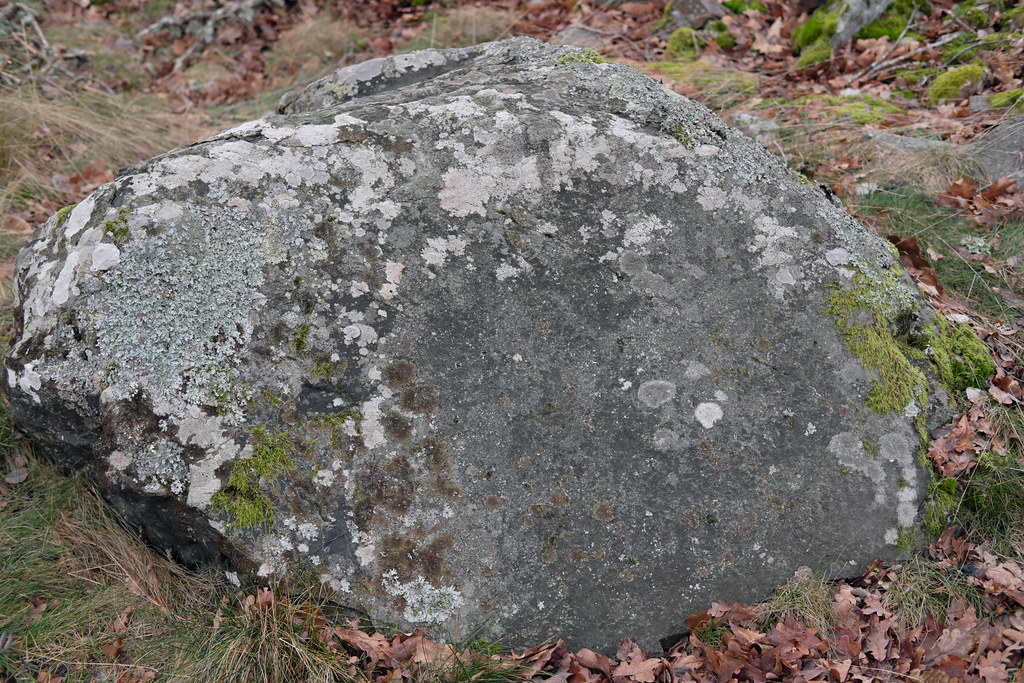
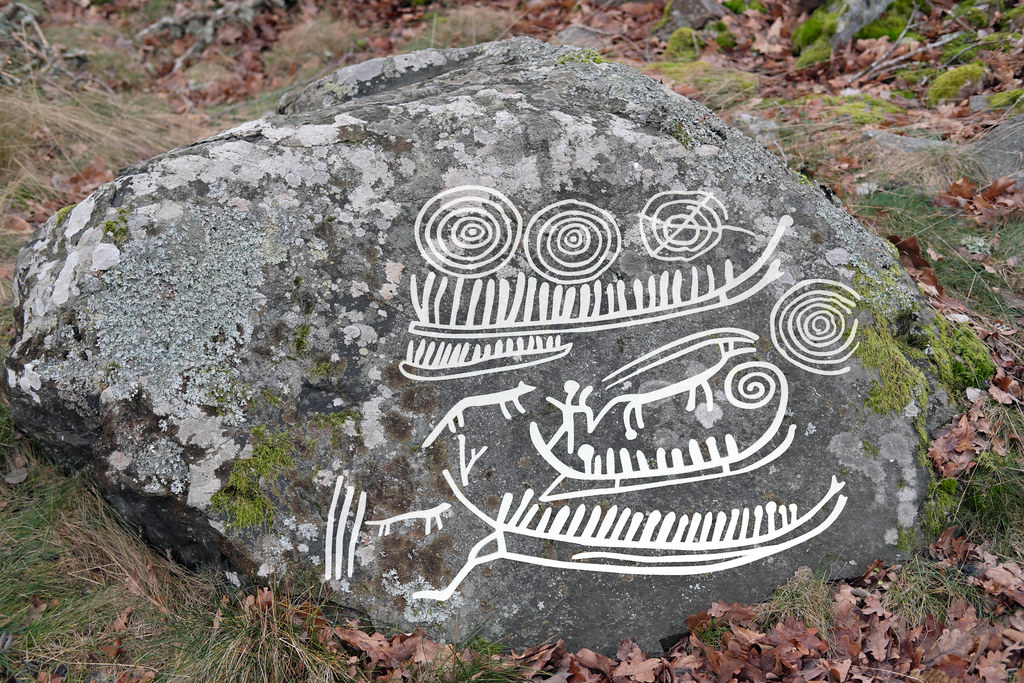
Utrikestenen near Lofta, Småland
Empty cup marks had been smeared with grease, after which sacrifices were made. Seeds, grains and coins were left as offerings in the pits. Rites were practiced by females, most probably wise women. The greasing was performed at sunset in counterclockwise motion, preferably three times. The smearing ritual supposedly cured various diseases caused by vindictive elves. Sources mention another healing practice: the rainwater, which collected in the holes, was considered to be a great remedy against warts.
Ballersten. A boulder with cup marks in Falköping, Västra Götaland
Similar beliefs existed in Slavic folklore as well. Water gathered in cup marks healed various ailments, especially eye diseases.
Stones with cup marks were later commonly associated with the cult of Mother Mary, when the pagan traditions were replaced (or rather overwritten) by the new faith. As both were eagerly blended together by rural folk, stones were of course considered very special. They served as sacrifice altars for the old gods and supernatural beings, and at the same time for Christian saints. Such stones could even protect from floods and wildfires. But some of them were affiliated with the devil and malicious forces – depending on the region.
A boulder in Malmö, Skåne
Polish archeologists link cup marks with fertility rites and kindling of the ritual fire during Midsummer and spring celebrations. It’s quite possible they were also used in funerary rites and to honor the ancestors.
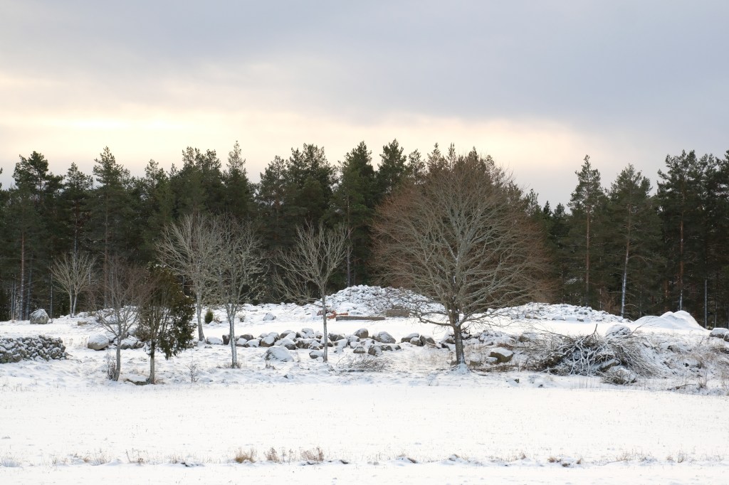
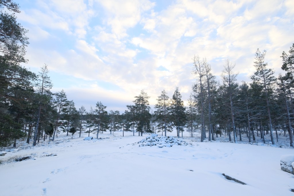
I’ve been looking forward to spend some time away from the city for a while now. Thankfully we’ve spent the last days of December in my husband’s hometown. Oskarshamn. Deep forests, the proximity of the sea and many places with history to visit.
Hauntings at Riskasten
This is a local spooky tale I’ve heard from my husband. The story comes from either the 17th or 18th century; from the time of famine. We visited this haunted place on a Christmas Eve morning. It is to be found in the forest between the villages of Forsa and Emsfors.
Around Christmas time, two or three kids from Forsalid were sent out by their parents to beg for food. In their search they came to a farm in Fågelsjö where they received a bread from a housewife. On their way back they met a man who saw them playing with it. When the man returned home he was told it was his wife who gave children the bread. He then became furious, threw himself on a horse, rode after the boys, killed them in the woods and hid their bodies under spruce twigs.
Since then the ghosts of the children still haunt this place. Many paranormal encounters can be confirmed by the local folk. A memorial plate has been mounted and everyday fresh spruce twigs are being laid there.
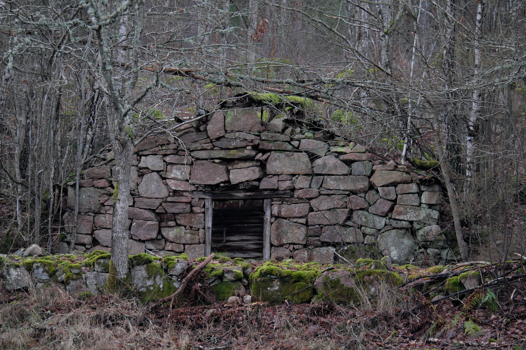
Closer towards Emsfors (back in the 18th and 19th century famous for its paper industry), I saw this stone cellar but I’m not quite sure when it was built.
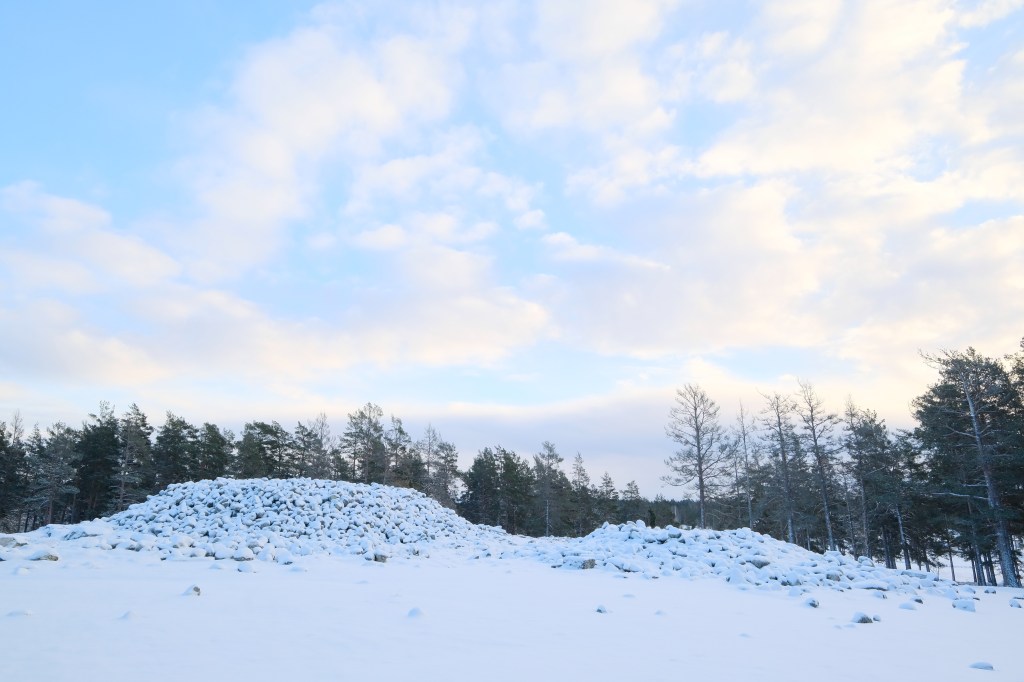
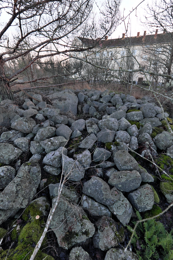
Cairn in Orrängen, Oskarshamn
A while ago, while browsing raa.se map, I’ve discovered a cairn in my parents-in-law neighborhood. So I’ve walked through the thicket surrounding the apartment building area, constantly peeking at the map and under my feet. Turned out that the cairn still stands, not far away from the grill place. It is also quite well preserved considering the placement. I’ve passed this place so many times and never before dared to investigate what hides behind the picnic table.
Petroglyphs in Västervik
I had high hopes for this one. I’ve checked the municipal pamphlet about Bronze Age sites in the Västervik area and planned the road trip accordingly. In reality most of the carvings are poorly marked and preserved; what’s filled in on the pictures has already faded away. Some of the places have also a restricted access – like those near Casimirborg, which turns out to be a private area.
Though I found a beautiful panel with a very much visible ship carving in Källsåker Gård just north of Västervik.
Next stop – Gamleby. According to the website the town is full of panels with petroglyphs, though mostly cup marks. The carving sites are in between the apartment buildings and it doesn’t really seem like they have any importance for the local community. The visit in Gamleby left my memory card empty and myself disappointed.
When leaving the town we found a runestone though; in close proximity to Garpedansberget. It’s a sculpture park full of trolls, tomtes and other creatures from the local folklore.
We continued towards Lofta where lays the famous Utrikestenen; now just a mossy stone that could be easily missed if not for the information plate. The boulder has some barely readable petroglyphs and cup marks that are still being filled with offerings. First of this kind I saw in person.
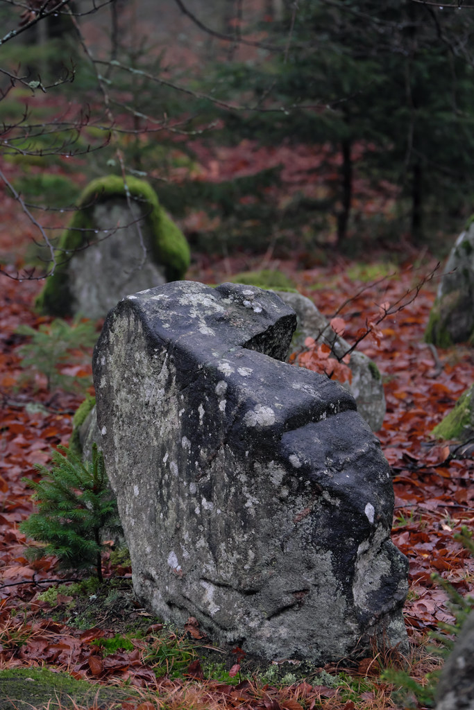
Ekeröds Gravfält
On the way back home we stopped at the diners in Ekeröd as we usually do when traveling on E22. Ekeröds grave field was on my list for quite a while, so I decided to pay this place a quick visit.
The grave field comes from the late Iron Age. There are few stone settings, domarringar (judge rings) and freestanding stones. Place have an unique atmosphere – feels haunted. There is a Bronze Age cairn and an offering well nearby, but sadly I had no time to investigate further.
I’ve already visited Erkes dös this spring. The trip was brief though – the day was extremely windy and I haven’t explored the area much more beyond this point. But the information plate got me curious back then. It mentioned a local legend about an ancient path connecting Erkes dös with another grave, Stora Kungsdösen. Also since the Skånetrafiken app kept crashing that day, I’ve still had an unused ticket for this route. Yes, this trip was meant to happen again. I’ve decided to give this walk another go, and follow the trolls’ footsteps.
I took an early train down to Trelleborg. Fields were completely covered with fog, as thick as milk. I saw a roe (or maybe a mythical hare) standing on top of a burial mound. Unfortunately, since I was on a train, I haven’t had time to react and take a picture.
After a short bus ride and a walk through the fields I’ve reached Erkes dös, a majestic passage grave in Lilla Isie. By the entrance to the main chamber there are about 30 cup marks on one of the rocks. The site was excavated in 1915; amber beads and flint offerings have been found.
The local legend says that there used to be a path leading across the fields to the Stora Kungsdösen at Östra Torp. The path was made by trolls who went back and forth to visit each other. The map on Riksantikvarieämbetet (Swedish National Heritage Board) actually shows that an ancient paved road existed in the area. It was uncovered and investigated by Folke Hansen in the 1920s. The road briefly connected Erkes dös with another (now non- existent) passage grave in the south-west, and continued north-east towards Stora and Lilla Kungsdösen.
Stora Kungsdösen is a double passage grave; one of three of this kind in Skåne. Both chambers are exposed as they are missing their roof blocks. Not far from here, 150m to the east, there is another passage grave overgrown by trees. It is locally known as Lilla Kungsdösen.
Fog slowly started to clear up as I walked towards the sea. I’ve continued east on the coastal road and soon after I’ve reached a Bronze Age burial site with a cairn – Flinthög.
I’ve took a small fika in Smygehuk, the southernmost tip of Sweden and whole Scandinavian peninsula. Besides the lighthouse (Smygehuks Fyr) and a small marina there is also a humongous lime kiln to see and an unique viper population to avoid.
There is a Bronze Age burial mound hidden behind the kiln, Bålhög, which served as a navigation point. Before the lighthouse was build in 1883, fires (bål) were lit on the mound to guide ships.
An aged beech tree accompanies the mound; I was very pleased to rest under its branches.