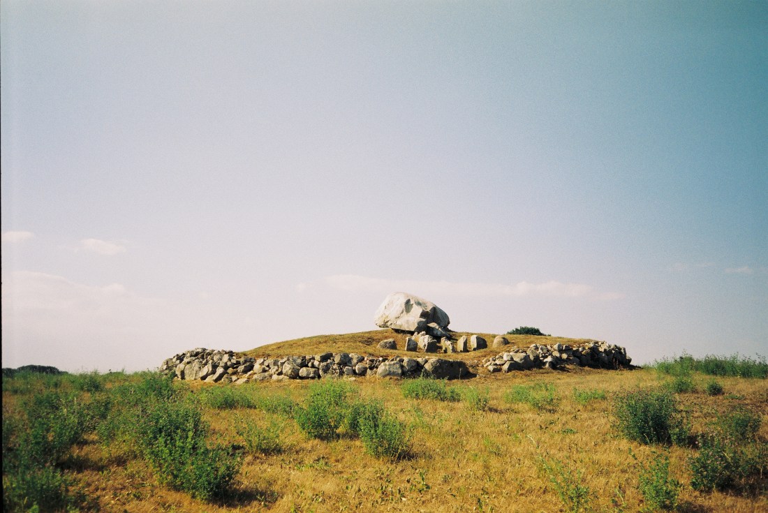
The area between Gladsax and Baskemölla is a distinct ancient landscape that is abundant in burial sites from different eras. One of them is located on a hill behind Rosdala Farm. The very much unique Stenstuan – a passage grave from the Stone Age.
Stenstuan was erected during the Farmer’s Stone Age and was used as a tomb for many generations. What makes it so unique is a variety of petroglyphs carved on its capstone. However, most of the carvings were added during the Bronze Age. Some researchers believe that a part of the 90 cup-marks at the top of the block, may have been carved when the tomb was built. In that case, there is a difference of a couple of thousand years between the first and last carving. The motives are quite few, but the variation is great. There are ships, axes, sun wheels and a circle. One ship carries a sun figure while another – a bowmen. The circle has been interpreted as a bracelet.
The grave was excavated in 1978 by Göran Burenhult. Many exciting discoveries were made, mostly from the Stone Age. Around 4000 ceramic fragments were found at the entrance to the chamber. Other finds included amber beads, burnt mussel’s shells, chisels and broken flint axes.
Photos taken with Olympus Mju I with a Fujicolor 100 negative.
A week after my day trip to Smygehuk my parents-in-law drove down and took us for a road trip around Österlen. It’s one of my favorite memories from last year.
We drove along the road number 9. It’s a smaller coastal road perfect for cruising and enjoying the view of the Baltic Sea. We had a fika in Smygehuk’s harbour and later continued along the road through Ystad to Simrishamn, where eventually we had a late lunch. The weather was quite enjoyable; the autumn sun hanged low, trees and grass already started to yellow.
A part of a humongous fairy ring I’ve spotted from the car.
The best part of the trip was a visit to Kiviks Musteri on the east coast. Since it was the apple season, they set up a small harvest festival: pick your own apples, have a fika and taste the local raw products. Before we enjoyed another cup of coffee and buns in the orchard, I’ve stocked up on apples and äpplemust.
While Kivik’s and Simrishamn’s areas are already quite familiar to me, we’ve checked out some previously unknown stone settings along the village roads.
Jarladösen
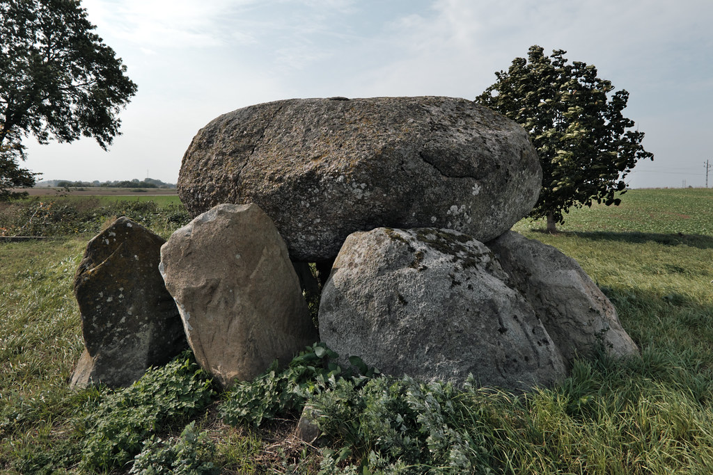
Jarladösen (Earl’s Dolmen) can be found behind a farm in Järrestad, close to where roads 9 and 11 join together. The village is famous for its well preserved petroglyph site Dansarens häll, which is located a bit towards Gladsax. We’ve already been there couple of years ago. But not many know about two dolmens hidden behind the buildings – Jarladösen, also known as Kycklinghönan since it resembles a hen, and Jarlafruns dös.
Skärabäcksdösen
Vik’s area is known mostly for close proximity of Stenshuvud National Park. But it’s also recognized for apple farming; orchards look truly beautiful this time of the year. Trees bend under the weight of apples as they ripen in the last rays of sunshine. At the end of the village we found Skärabäcksdösen – it was on my list for a while now, but as we took our time and went where the roads took us, we stumbled upon that one by surprise.
Vitabyhus
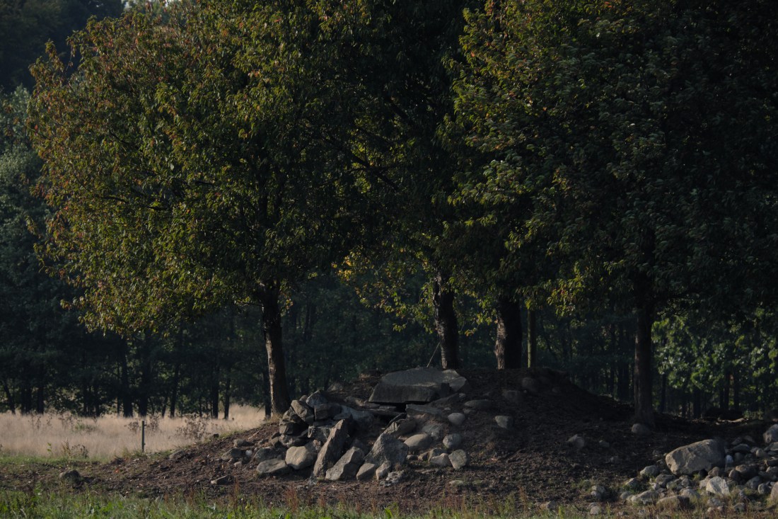
On the way back home, cruising through the farms and meadows, I’ve spotted some peculiar structures on the pasture past Vitaby. They turned out to be Bronze Age burial mounds. They are quite eroded now due to extensive farming. Originally it was four of them on the field, but I’ve spotted only two.
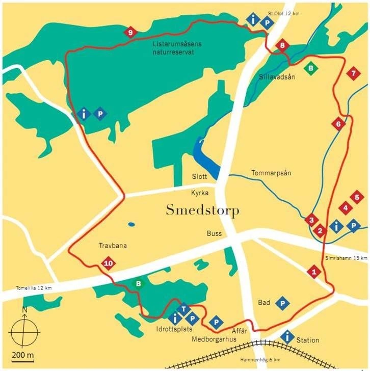
Gårdlösaleden is one of the trails on east coast of Skåne, Österlen. The 12 km loop can be easily taken in one day, in a matter of fact – couple of hours with short breaks is enough. The hike begins in a cozy village of Smedstorp near the train station. Let’s go!
First kilometre is fairly uneventful – I need to walk out of the built-up area first. I take the gravel road that takes me trough pastures. First stop – remains of a stone ship called Alnabjär Skeppssättning (3) are up on a hill. Since it’s missing most of the stones I choose to skip it and head for the “main course” just 1 km away – three stone formations from Iron Age hidden away in a thicket.
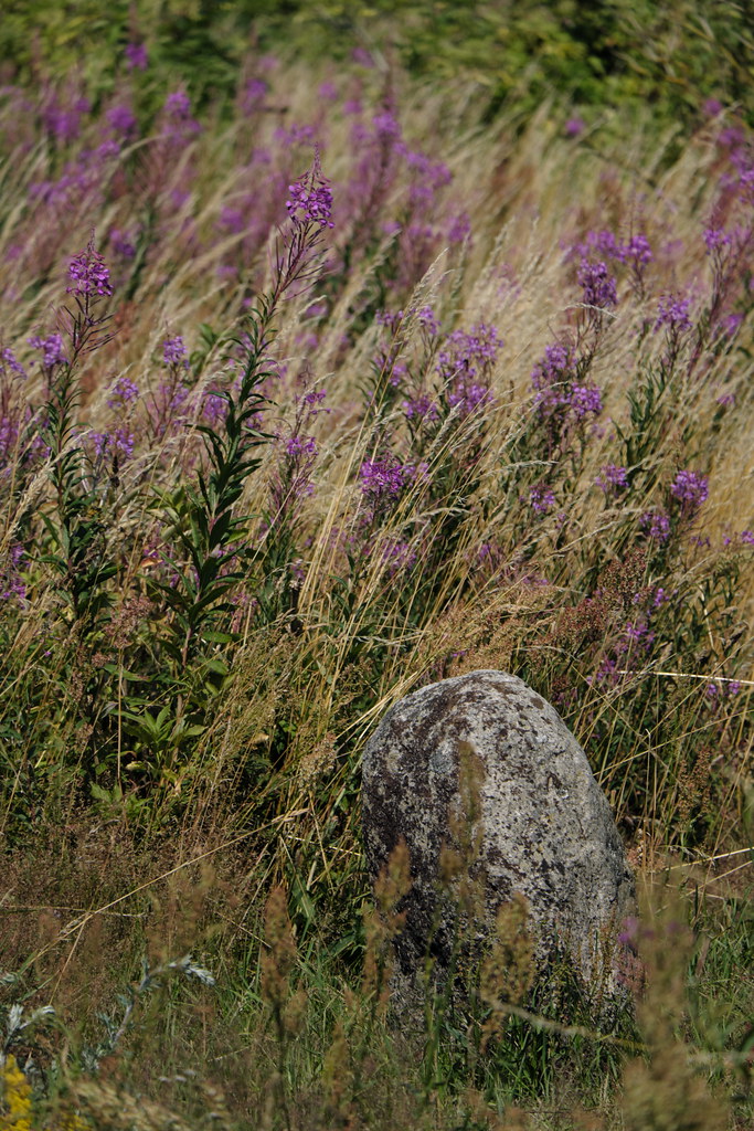
Stones rest on a hill; from here I have a view over surrounding corn fields. There is two stone ships and one overgrown stone circle, domarring (4). A bit northwest from here there’s Silverflickans grav (5) – an Iron Age grave of a young women buried along with silver artifacts. Plants growing here are quite suggestive – elder and hawthorn are both the guardians of the Otherworld, while fireweed is a symbol of rebirth.
After enjoying my time with the stones I’m back on the route. Along the main trail there are remains of two limestone quarries – Kalvahagens stenbrott and Stora stenbrottet (6 & 7).
Soon the landscape changes as I enter the small forest with a stream running through. There’s a tiny waterfall too! A couple of meters from the wooden bridge there is a humongous lime kiln (8). Lime used to be transported here from quarries down the road, burned in order to lose weight and turn white, and extinguished with water from the stream.
As I’m out of the forest area, I cross the main road and enter the Listarumsåsen Nature Reserve. It’s so beautiful and quiet. I’m all alone here, just what I was craving for. The trail goes through the whole length of reserve, forest changes along the way – one time there is only spruce, then beeches start to dominate and it gets denser and darker. I pass a peat extraction site from the beginning of XX century (9).
There is also a peculiar Oak growing along the way, marked by a helpful hiker. Why does it stand on two legs is a mystery. Maybe it’s a tree giant, or maybe the hole is a portal to the Otherworld?
After quite some time I finally emerge from the woods. For the next 3 km the trail will lead through fields and pastures, which gives me the opportunity to focus on medicinal plant growing along the way. The abundance of the black mullein and meadowsweet sweeps me from my feet. Next July I’ll definitely come here to pick them for my herbarium, since I can’t locate them in my neighborhood. But there are also plenty of habitats of musk mallow, thistle, burdock, tansy, wild geranium, chicory, wild thyme, St. John’s wort, and I’ve spotted at least one with angelica.
The last stop on a map is Ljungavången Nature Reserve (10) which is a home to rare frog species called onion frog. Since the possibility of meeting one is close to none I decide to head for the train station.
Around the 10th kilometre I enter a small foresty area with, well, a weird theme. Here Santa Claus gnomes are everywhere. Trees are adorned with Christmas decorations, but all of them feature only Jultomten. Not gonna lie this really creeps me out at first, but then I start to get really curious. But so far I didn’t find any compelling backstory to this.
Since I’m late for my train back home, I take a coffee in a local shop and brush off all the bugs that crept on me along the way. I’m tired but my mind is at peace again. It was a good day.
You can find more photos from this hike in my Flickr album.
Don’t get fooled by Skånes flat and mundane landscape. It certainly IS the place where magic happens – ancient stones might speak to you when you dare to listen. Especially here. At the southernmost tip of Sweden, where land meets endless sky and sea.
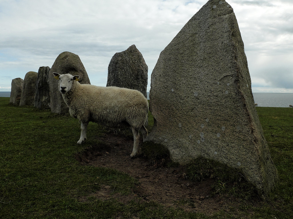
Ales Stenar is truly a remarkable megalithic monument. You can find it in Kåseberga, a couple of kilometres east from a charming little town of Ystad. The stone complex is located on a cliff overlooking my beloved Baltic Sea. It is 67 meters long, formed by 59 large boulders in a shape of an oval ship. Worth noting: stones at both ends are much larger than the rest. These rocks have been erected probably around the end of Nordic Iron Age, but neither me, nor my scientific sources, can be sure about the exact date of creation. Opinions in this matter vary greatly – from 5,000 BC to 10th century AD.
Ales Stenar has been used as a burial ground for centuries. Excavations performed on the site in 1989 verified this theory. Many clay pots with charred human bones have been found at that time, proving that the burial rituals were performed there for many, many centuries. Other archaeological findings include traces of bonfires and feasts.
But there is more! The specific placement of the boulders denotes that this construction has been used as a solar calendar too. Those bigger stones, that I’ve mentioned before, precisely mark the sun’s positions on the sky during Summer and Winter solstices. And those can be observed while standing on the flat stone in the middle of the circle during sunrises and sunsets, respectively.
The obvious multi functionality of this place is not a surprise to me, as ancient societies worshiped their ancestors, deities and nature in one sacred space. And as of this years Midsummer, thankfully this tradition is not over yet.
You can see more photos from this location in my Flickr album.