Snäckedals Grave Field

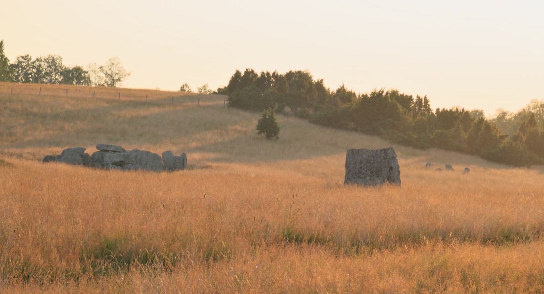
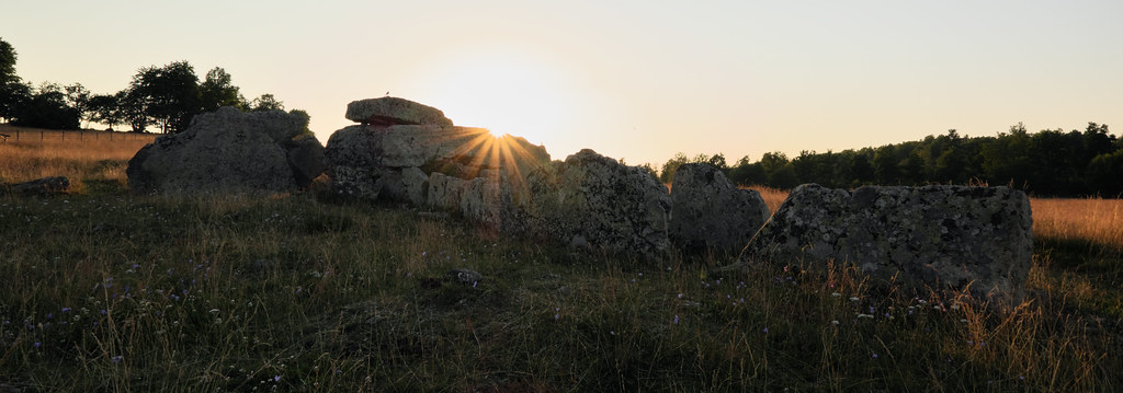
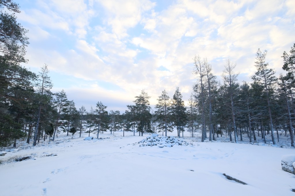
Snäckedals is a notable grave field located north of Snäckedal farm in Misterhults parish near Oskarshamn. This burial ground is dated to the Bronze Age, containing 26 ancient remains, and is one of the biggest of this kind to be found in Sweden. Back in the ancient times it was probably an important ritual and spiritual center, perhaps a final resting place for the elite involved in the copper trade.

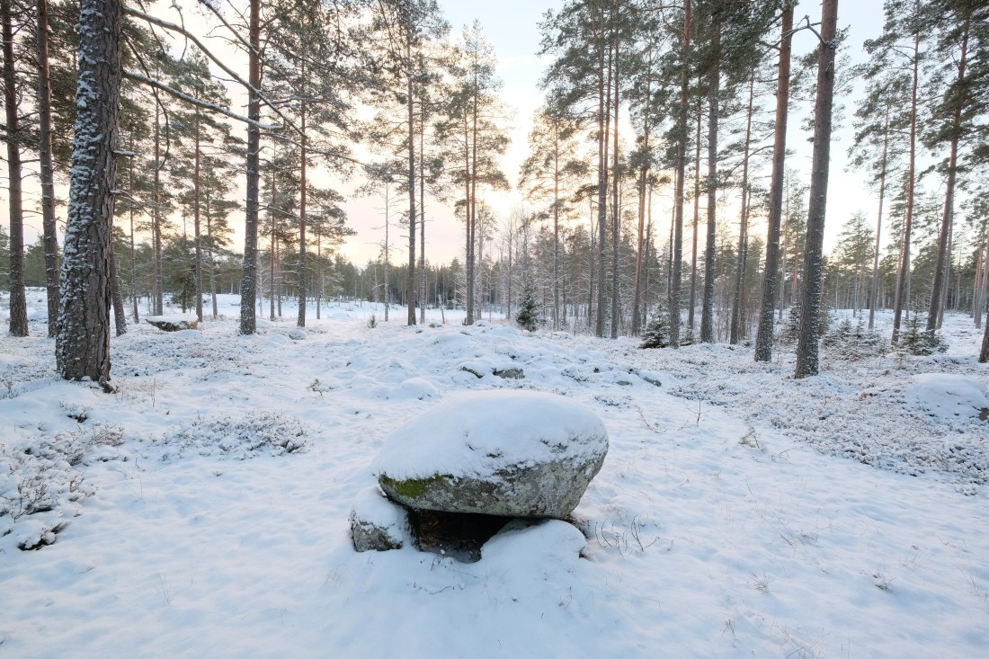
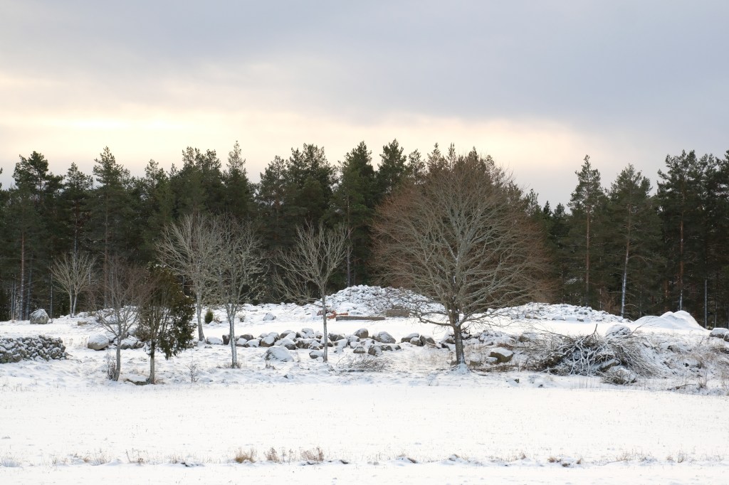
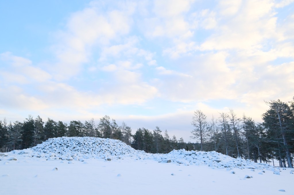
First time I explored the area in September ’17 on a misty day when the heather was in full bloom. Though currently hidden under a layer of snow, most of the graves are still discernible: 5 cairns, 13 round and 5 rectangular stone settings, 2 ship-shaped stone settings – one of them being 40 meters long is the largest in Sweden, as well as a small raised block (so called höna på ägg) which is my favourite. The largest cairn is 21 meters in diameter and 3 meters high.

The small raised block resembling a mini-dolmen or a nesting hen is actually a man made stone formation found on some Bronze and Iron Age burial sites in Sweden. Originally raised as graves, they were used in various rituals later on (often as offering stones), or being surrounded by superstitions were thought to be dwellings of supernatural beings.

Sources (access Dec 2021):
1. http://misterhultaren.blogspot.com/2008/12/snckedal-en-bronsldersgta.html
2. https://sv.wikip
edia.org/wiki/Uppallat_block

Ekornavallen

As soon as we installed ourselves in Skövde, we drove up here after a day long drive down from Bollnäs. Just in time for the sunset. Last warm rays of sunlight made the grass turn copper; swarms of flies became fairy dust. As I was walking around the meadow a pair of birds kept me company and followed me wherever I went. Even though I couldn’t identify them, I was grateful for their company for the evening, as it sometimes gets lonely among the graves. Soon after we left to catch Amundstorp in the last moments of the golden hour.

Ekornavallen is an ancient burial ground in the Falköping Municipality in Sweden. Situated in Slafsan River valley, it contains a variety of ancient monuments dating from the Stone, Bronze and Iron Ages.

What’s unusual, there were no settlements in the area until the 18th century. As of the late 19th century the area was plowed up, which sadly destroyed many of the precious remains.

Today Ekornavallen contains four passage graves and a gallery grave from the Neolithic period, as well as cairns from the Bronze Age, stone circles, twelve standing stones (bautastenar) – marking the Iron Age burials, eight round stone settings and one triangular stone setting. Many stones are adorned with cup marks too. It is estimated that the field was in use for over a six to seven thousand-year period.

The largest, and best known, grave on a meadow is the Neolithic passage grave Girommen. According to historians the name translates to the giant woman’s oven. It could be a resting place of many individuals, possibly an entire family. The burial chamber is thirteen meters long and two meters wide. It stands on a barely recognizable stone setting that is 37 meters in diameter. All boulders are made of sandstone except for the granite roof stone; probably a glacial erratic from Närke. The grave was restored in the 1940s and some burial offerings such as amber beads, pottery shards and a flint chisel have been found. In recent years the walls has been filled to prevent the passage grave from further collapse.

Sources (access Nov 2021):
1. www.sfv.se/fastigheter/sok/sverige/vastra-gotalands-lan/ekornavallen
2. www.vastsverige.com/en/falkoping/produkter/ekornavallen
3. www.
lansstyrelsen.se/vastra-gotaland/besoksmal/kulturmiljoer/ekornavallen.html

Megalithic Walk around Lilla Isie parish

I’ve already visited Erkes dös this spring. The trip was brief though – the day was extremely windy and I haven’t explored the area much more beyond this point. But the information plate got me curious back then. It mentioned a local legend about an ancient path connecting Erkes dös with another grave, Stora Kungsdösen. Also since the Skånetrafiken app kept crashing that day, I’ve still had an unused ticket for this route. Yes, this trip was meant to happen again. I’ve decided to give this walk another go, and follow the trolls’ footsteps.

I took an early train down to Trelleborg. Fields were completely covered with fog, as thick as milk. I saw a roe (or maybe a mythical hare) standing on top of a burial mound. Unfortunately, since I was on a train, I haven’t had time to react and take a picture.

After a short bus ride and a walk through the fields I’ve reached Erkes dös, a majestic passage grave in Lilla Isie. By the entrance to the main chamber there are about 30 cup marks on one of the rocks. The site was excavated in 1915; amber beads and flint offerings have been found.

The local legend says that there used to be a path leading across the fields to the Stora Kungsdösen at Östra Torp. The path was made by trolls who went back and forth to visit each other. The map on Riksantikvarieämbetet (Swedish National Heritage Board) actually shows that an ancient paved road existed in the area. It was uncovered and investigated by Folke Hansen in the 1920s. The road briefly connected Erkes dös with another (now non- existent) passage grave in the south-west, and continued north-east towards Stora and Lilla Kungsdösen.

Stora Kungsdösen is a double passage grave; one of three of this kind in Skåne. Both chambers are exposed as they are missing their roof blocks. Not far from here, 150m to the east, there is another passage grave overgrown by trees. It is locally known as Lilla Kungsdösen.

Fog slowly started to clear up as I walked towards the sea. I’ve continued east on the coastal road and soon after I’ve reached a Bronze Age burial site with a cairn – Flinthög.

I’ve took a small fika in Smygehuk, the southernmost tip of Sweden and whole Scandinavian peninsula. Besides the lighthouse (Smygehuks Fyr) and a small marina there is also a humongous lime kiln to see and an unique viper population to avoid.

There is a Bronze Age burial mound hidden behind the kiln, Bålhög, which served as a navigation point. Before the lighthouse was build in 1883, fires (bål) were lit on the mound to guide ships.

An aged beech tree accompanies the mound; I was very pleased to rest under its branches.

Fagertofta Burial Ground

Fagertofta burial ground lays north of Nässjö on a banked meadow sheltered by a forest. The area was excavated and restored in 1940s – amost all graves date to the Iron Age. The burial site is also known as Domsätet, due to the presence of dommaringar*, and Hallängen – The Hall Meadow. Never heard of this place before. I’ve discovered it in an old book I’ve got from an antique bookshop.

The grave field contains 42 ancient stone formations varied in form, shape and size. Mostly stone circles (38, including 25 domarringar) but there is also a Bronze Age cairn (for cremation burials) and a mysterious three-armed barrow with an altar. What’s unusual, one of the circles is formed from 6 tiny dolmens, also known as “lying hens”.

By the gravel road leading to the site there is an old sacrificial well, Midsommarkällan. It was used in the past for ritual ablutions during Midsummer celebrations.

We approached the site during a very hot and sunny afternoon, so shooting conditions were far from ideal. I walked around the stones for a while, briefly composing my shots and waiting for clouds to set in. Maybe it was a symptom of a sunstroke, but I swear I could hear the chanting among the dolmen ring coming from the dark forest behind it. The official information leaflet does warn about “playing around” the stones – that can make one ill.

* Domarringar – Stone circles with odd number of stones (usually 7 or 9); often with an additional stone in the middle. The name might came from a medieval view that judge rings were a kind of court places where important decisions were made. With the odd number of stones, a judgment could always pass.

You can find more photos from this location in my Flickr album.